FindIt Current Projects
FindIt is currently undertaking two large surveys of Athens-Clarke County and Macon, GA to document mid-century commercial and residential resources. We are also conducting a smaller survey of the Normaltown neighborhood of Athens and creating a Storymap as part of our outreach to residents. Students are helping our statewide partners test a new survey app based on ESRI's ArcGIS Field Maps app but customized to integrate with the GNAHRGIS statewide database.
Notable past projects and a link to all county survey reports are at the bottom of this page.
Mid-Century Resources, Athens-Clarke Co. GA
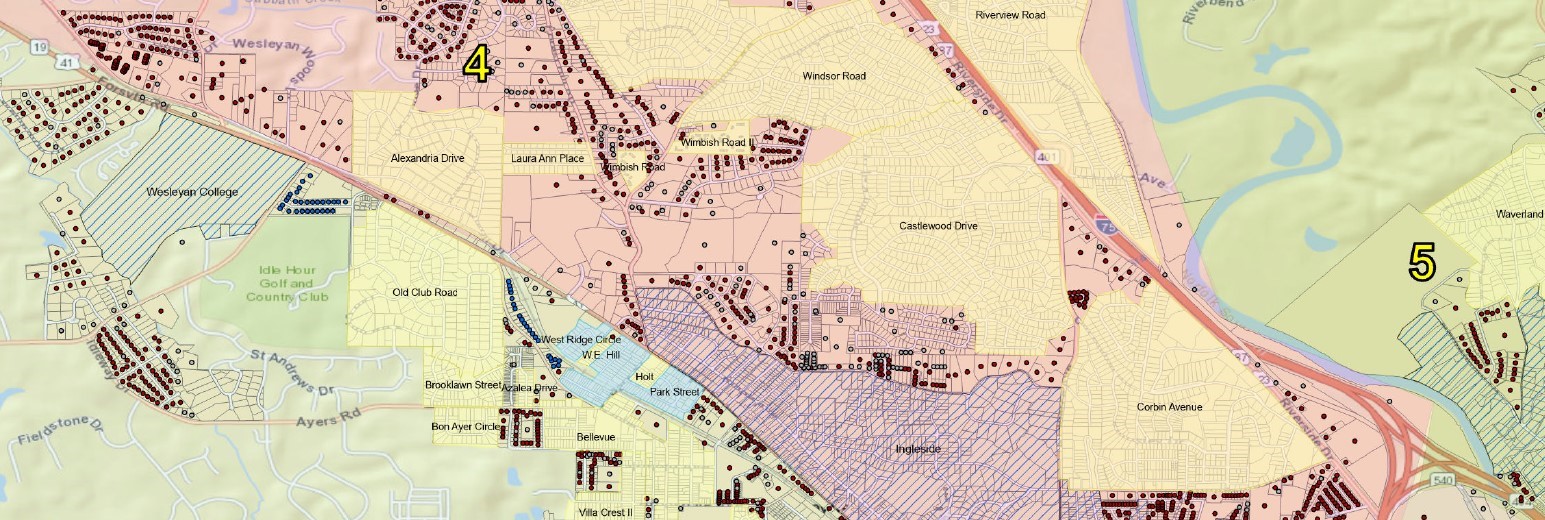
This survey of the unincorporated areas of Athens-Clarke County began in 2019. It
is a multi-year initiative conducted at the behest of Georgia Transmission Corporation
(GTC), FindIt’s main sponsor. The majority of these resources are mid-century subdivisions
that include the ubiquitous Ranch House as well as residences that reflect post-war
Modernism as well as neo-traditional styles and forms.
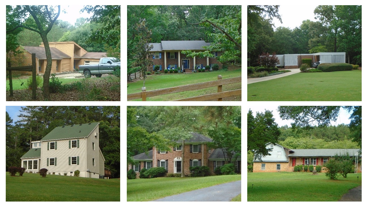
A sample of the wide variety of 1070s era residential buildings found in the Idylwood area of Athens-Clarke County.
Normaltown neighborhood, Athens GA
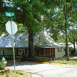
FindIt began a survey of Normaltown in Summer 2023 to practice recognizing types and
styles of residential buildings from the early 19th century up to the mid-20th century. Our general area will be bounded by Oglethorpe Ave, Clover St/Sunset Dr,
King Ave, and Prince Ave. FindIt is developing a StoryMap for residents to easily
access our research and learn about the history and evolution of their neighborhood
with a sampler of architectural types and styles that are prevalent.

GNARHGIS Field Survey App testing
FindIt students are helping the State Historic Preservation Office (Historic Preservation
Division-DCA) test a new app called CRSurveyor that was developed by the National
Park Service and is based on ESRI's ArcGIS Field Maps app. Our partners at the UGA
Carl Vinson Institute of Government have customized this app to align with the statewide
database known as "GNAHRGIS," a catalog of information about the state's natural, archaeological, and historic
resources. This app will streamline field surveys by allowing for photographs to
be geo-located and associated with data collected in real time.

Mitigation Survey, Macon GA
This windshield survey is a multi-year endeavor that FindIt is undertaking on behalf
of GDOT as part of a mitigation proposal for a federal highway project. FindIt is
tasked with documenting buildings and districts built before 1981 that are not already
designated as historic. The scope of work includes about 28,000 parcels that are 40
years old or older.
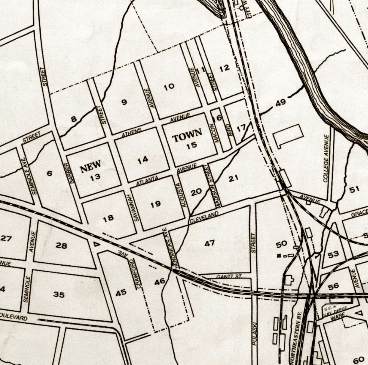
Carr’s Hill was one of the first developed areas of Athens, located on acreage given
to Elijah Walker by the University of Georgia in payment for his services in surveying
land for the new campus. FindIt documented a total of 92 historic structures within
the Carr’s Hill area, with the majority constructed between 1910 and 1950. These
resources are predominately single-family residential structures with a few apartment
complexes, as well as a church and a former school.
Interactive StoryMap | Final Report PDF
The name “Newtown” can be traced back to the late 1800s. Though the neighborhood has
evolved from its origins as a predominantly Black residential neighborhood, its architectural
resources reflect its history, demonstrated through the numerous working-class homes
and public housing sites. FindIt documented a total of 152 historic buildings within
the Newtown neighborhood, with the majority constructed between 1910 and 1929. These
resources are predominately single-family residential structures, interspersed by
a few public housing units.
Interactive StoryMap | Final Report PDF
Kodachrome Commerce E-Symposium
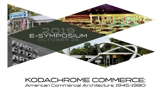
Hosted by the University of Georgia on October 25, 2019, the Kodachrome Commerce E-Symposium was a free, one-day event featuring the research of eleven different presenters, covering a wide variety of topics related to the preservation of mid-century commercial architecture. The primary motivation for initiating the Symposium was the continuation of FindIt’s research concerning mid-century commercial architecture and the imminent need for an academic framework and methodology for the identification and evaluation of post-war commercial architecture. A full description of the conference and links to all presentations are below.
Symposium website and Video presentations
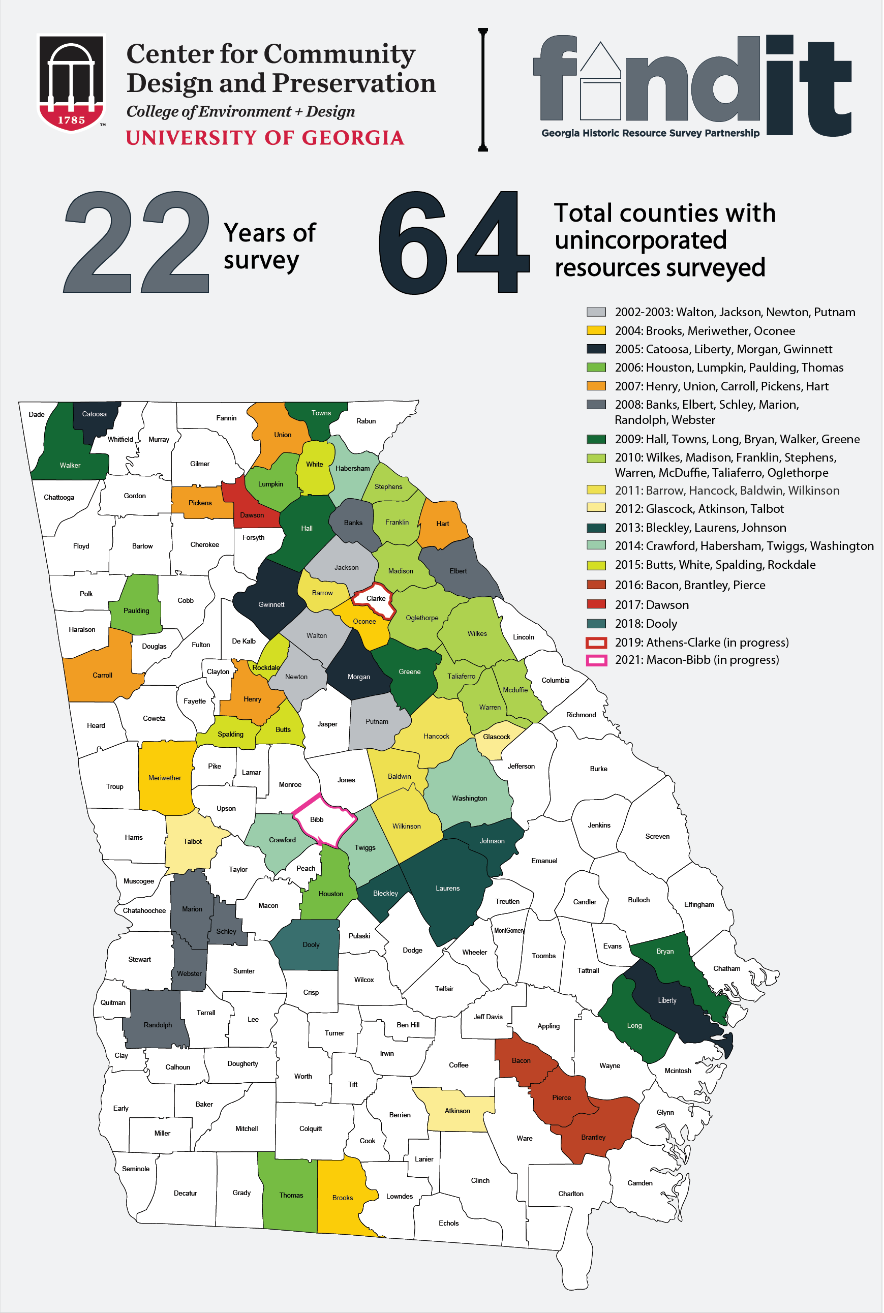 The links below include snapshots and full reports of past FindIt survey projects.
If you are looking for a particular set of information on your community that might
be in our files, please email jmlewis@uga.edu.
The links below include snapshots and full reports of past FindIt survey projects.
If you are looking for a particular set of information on your community that might
be in our files, please email jmlewis@uga.edu.
OVERVIEWS | Quick 2-pager snapshots (PDFs) of past surveys, listed alphabetically.
SURVEY REPORTS | A sampling of complete reports (PDFs) of past surveys, listed alphabetically.