College of Environment and Design

Snail Farming In Georgia

Contact

borland@uga.edu
Upload a project photo Snail Farming in Georgia

Brian Orland and multiple students

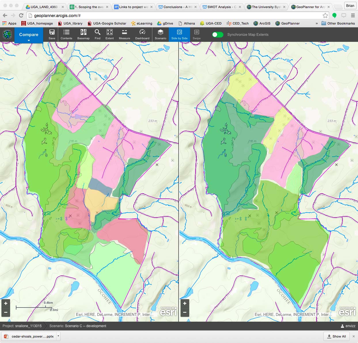
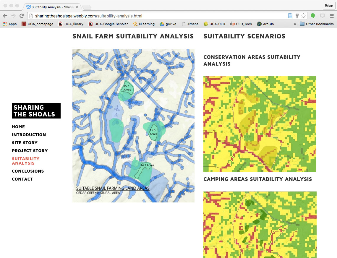
The site selection for a hypothetical edible snail farm was used to introduce GeoPlanner® as a geodesign platform, the unfamiliar topic chosen deliberately to engage students in LAND4360, Applied Landscape Ecology, in bringing landscape performance metrics to evidence-based design scenarios. GeoPlanner® is an interactive geodesign tool supported by on-line resources delivered by the ArcGIS Online repository. a combination of Google Docs® to support Delphi- like priority setting, ESRI GeoPlanner® for spatial analysis and ESRI Story Maps® supports students in creating design narratives that critically engage the problem of concurrently protecting valuable habitat and yet promoting economic development.

Context

Geodesign, environmental design at geographic scale, by necessity engages a wide range of natural and social systems. It is also a domain in which design solutions are expected to be supported by evidence—of the land use changed, the ecosystem services increased or reduced, and of their contribution to environmental justice. The snail farm project provides a “double-loop” learning structure in which student participants, through repeated attempts to solve problems, modifying the original goals, learn to design from the perspective of their own values while maintaining explicit awareness of the many others in play.


More details at: Orland, B. 2016. Geodesign to Tame Wicked Problems. Journal of Digital Landscape Architecture. (1) 187-197.

Portfolio

    12

    Team Members

    Brian Orland; Mackenzie Battista; Linna Yuan; Morgan Landers; Katie Sewell; Natasha Burr; Tyler Newborn

    Sponsor

    National Science Foundation Award: DRL-1114670
    © University of Georgia, Athens, GA 30602
    706‑542‑3000